


ROME 1 Voting District, Jefferson County, Illinois
About
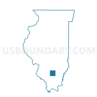
Outline

Summary
| Unique Area Identifier | 571324 |
| Name | ROME 1 Voting District |
| County | Jefferson County |
| State | Illinois |
| Area (square miles) | 18.46 |
| Land Area (square miles) | 18.41 |
| Water Area (square miles) | 0.05 |
| % of Land Area | 99.75 |
| % of Water Area | 0.25 |
| Latitude of the Internal Point | 38.42882370 |
| Longtitude of the Internal Point | -88.95307970 |
Maps


Graphs
Select a template below for downloading or customizing gragh for ROME 1 Voting District, Jefferson County, Illinois


Neighbors
Neighoring Voting District (by Name) Neighboring Voting District on the Map
- FIELD Voting District, Jefferson County, IL
- HAINES Voting District, Marion County, IL
- MOUNT VERNON 5 Voting District, Jefferson County, IL
- RACCOON Voting District, Marion County, IL
- ROME 2 Voting District, Jefferson County, IL
- SHILOH 2 Voting District, Jefferson County, IL
Top 10 Neighboring County Subdivision (by Population) Neighboring County Subdivision on the Map
- Mount Vernon township, Jefferson County, IL (13,374)
- Shiloh township, Jefferson County, IL (6,620)
- Rome township, Jefferson County, IL (1,669)
- Raccoon township, Marion County, IL (1,541)
- Field township, Jefferson County, IL (1,468)
- Haines township, Marion County, IL (1,002)
Top 10 Neighboring Place (by Population) Neighboring Place on the Map
Top 10 Neighboring Elementary School District (by Population) Neighboring Elementary School District on the Map
- Woodlawn Community Consolidated School District 4, IL (2,769)
- Rome Community Consolidated School District 2, IL (2,757)
- Field Community Consolidated School District 3, IL (2,445)
- Raccoon Consolidated School District 1, IL (2,369)
- Kell Consolidated School District 2, IL (1,023)
Top 10 Neighboring Secondary School District (by Population) Neighboring Secondary School District on the Map
- Mount Vernon Township High School District 201, IL (29,760)
- Centralia High School District 200, IL (21,619)
- Salem Community High School District 600, IL (15,204)
- Woodlawn Community High School District 205, IL (3,330)
Top 10 Neighboring State Legislative District Lower Chamber (by Population) Neighboring State Legislative District Lower Chamber on the Map
Top 10 Neighboring State Legislative District Upper Chamber (by Population) Neighboring State Legislative District Upper Chamber on the Map
Top 10 Neighboring 111th Congressional District (by Population) Neighboring 111th Congressional District on the Map
Top 10 Neighboring Census Tract (by Population) Neighboring Census Tract on the Map
- Census Tract 9522, Marion County, IL (4,181)
- Census Tract 501, Jefferson County, IL (4,181)
- Census Tract 507, Jefferson County, IL (3,898)
- Census Tract 505, Jefferson County, IL (3,703)
- Census Tract 9523, Marion County, IL (3,599)
Top 10 Neighboring 5-Digit ZIP Code Tabulation Area (by Population) Neighboring 5-Digit ZIP Code Tabulation Area on the Map
- 62864, IL (24,108)
- 62801, IL (22,415)
- 62830, IL (1,392)
- 62853, IL (1,034)
- 62893, IL (977)
- 62889, IL (851)